Department of Public Works (DPW) - Projects
DPW PROJECTS
CURRENT PROJECT STATUS
Last Updated 7/15/2024
TRAFFIC IMPACT |
PROJECT |
TOWN |
START |
EXPECTED COMPLETION |
PROJECT STATUS |
CONTRACT |
LINK TO PROJECT |
|
Resurfacing Segments of NYS Rt. 22 from I-84/I-684 Interchange to NYS Route 55 |
Patterson, Southeast, Village of Brewster |
3/24/2024 |
8/31/2024 |
NYSDOT | DYN_PROJECT_DETAILS |
|||
|
Rt. 311 & Ludingtonville Road Culvert Replacement |
Patterson |
7/15/24 |
10/21/24 |
NYSDOT | |||
|
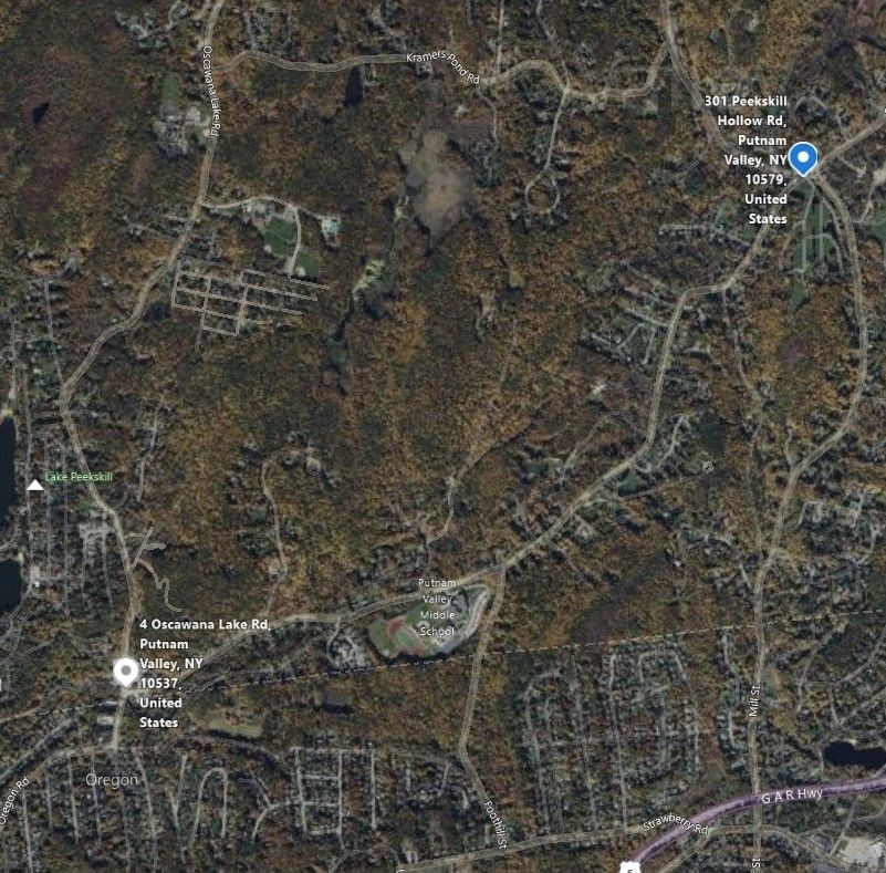
Peekskill Hollow Road Reconstruction |
Putnam Valley / Kent |
7/31/23 |
11/8/2024 |
PUTNAM COUNTY / ELQ |
|||
|
Sprout Brook Road |
Philipstown |
TBD |
TBD |
Award |
|||
|
Fair Street (CR 60) Reconstruction |
Carmel |
TBD |
TBD |
Award |
|||
 |
Maybrook Bikeway II, Bridge 5 | Brewster | TBD | TBD |  |
Award | |
 |
NYCDEP West Branch Auxiliary Dam Slope Stability Improvements | Carmel | 3/24//2023 | 2025 |  |
Department of Environmental Protection (nyc.gov) | LEARN MORE |
 |
Stoneleigh Ave & Drewville Rd Intersection Impovements | Carmel | TBD | TBD |  |
Final Design | LEARN MORE |
 |
Secor Rd. Paving from Wood St. Intersection to Butterfly Ln. | Mahopac | 7/17/2024 | 1-2 weeks |
 |
Paleen/Clove | |
 |
Stoneleigh Ave. Paving from Westchester line to Magnetic Mine Rd. | Carmel |
Mid-Late |
1-2 weeks |
 |
Paleen/Clove | |
 |
Doansburg Rd. Paving from Mt. Ebo Rd. N. to Fairfield Dr. | Southeast | Mid-Late August |
1-2 weeks |
 |
Paleen/Clove | |
 |
Peaceable Hill Rd. and Crosby Ave Paving | Brewster | July 22nd - Early August |
2-3 weeks |
 |
Paleen/Clove | |
 |
Fair Street Paving, John Simpson to Hill and Dale Rd | Carmel | July 22nd - Early August |
1-2 weeks |
 |
Paleen/Clove | |
- Project Status: On Schedule

- Town:Patterson, Southeast, Village of Brewster
- Start: 3/24/2024
- Expected Completion: 8/31/2024
- Traffic Impact: Minimal Delays

- Contract: NYSDOT | DYN_PROJECT_DETAILS
- Click to learn more about this project
- Project Status: On Schedule

- Town: Patterson
- Start: 7/15/24
- Expected Completion: 10/21/24
- Traffic Impact: Expect Some Delays

- Contract: NYSDOT
- Click to learn more about this project
- Project Status: On Schedule

- Town: Putnam Valley/ Kent
- Start: 7/31/23
- Expected Completion: 11/8/24
- Traffic Impact: Expect Some Delays

- Contract: Putnam County / ELQ
- Click to learn more about this project
- Project Status: On Schedule

- Town: Carmel / Kent
- Start: TBD
- Expected Completion: TBD
- Traffic Impact: Expect Some Delays

- Contract: Award
- Click to learn more about this project
- Project Status: On Schedule

- Town: Carmel / Kent
- Start: TBD
- Expected Completion: TBD
- Traffic Impact: Expect Some Delays

- Contract: Advertisement / letting 6/7/2024
- Click to learn more about this project
- Project Status: On Schedule

- Town: Brewster
- Start: 11/15/23
- Expected Completion: 12/15/24
- Traffic Impact: Expect Some Delays

- Contract: Advertisment Pending
- LEARN MORE
- Project Status: On Schedule

- Town: Carmel
- Start: 3/24/24
- Expected Completion: 2025
- Traffic Impact: Expect Some Delays

- Contract: Department of Environmental Protection (nyc.gov)
- LEARN MORE
- Project Status: On Schedule

- Town: Carmel
- Start: TBD
- Expected Completion: TBD
- Traffic Impact: Expect Some Delays

- Contract: Final Design
- LEARN MORE
- Project Status: On Schedule

- Town: Mahopac
- Start: 7/17/2024
- Expected Completion: 1 - 2 Weeks
- Traffic Impact: Expect Some Delays

- Contract: Paleen/Clove
- LEARN MORE
- Project Status: On Schedule

- Town: Carmel
- Start: Mid-Late July
- Expected Completion: 1 - 2 Weeks
- Traffic Impact: Expect Some Delays

- Contract: Paleen/Clove
- LEARN MORE
- Project Status: On Schedule

- Town: Southeast
- Start: Mid-Late August
- Expected Completion: 1 - 2 Weeks
- Traffic Impact: Expect Some Delays

- Contract: Paleen/Clove
- LEARN MORE
- Project Status: On Schedule

- Town: Brewster
- Start: Early August
- Expected Completion: 2-3 Weeks
- Traffic Impact: Expect Some Delays

- Contract: Paleen/Clove
|
|
Minimal Traffic Impact |
Traffic flow expected normal in construction area. |
|
|
Intermittent Traffic Impact |
Traffic may be reduced to one lane at times. |
|
|
Temporary Detour Route |
A temporary detour route is in place. Hours of detour may vary. |
|
|
On Schedule |
Project is expected to start and to be completed on schedule. |
|
|
Moderate |
Project is expecting unforseen issues which MAY delay the start and/or completion date |
 |
Delayed | Project is expecting unforseen issues which WILL delay the start and/or completion date |
PROJECT
NEWS UPDATES
-
 Peekskill Hollow Road Reconstruction Update
 -
 The Drewville Rd Bridge over The West Branch of the Croton River is now open to traffic.
 -
 Monday 9/25/2023, DPW crews will be preforming Drainage work along Secor Rd. (Weather Permitting)
 -
 PIN 8757.65 Drewville Rd. Bridge over W Branch Croton River
 -
 2023 Road Paving Program Updates
 -
 Status of the County’s Peekskill Hollow Road Project
 -
 Letter to the Supervisor - Status of the County’s Peekskill Hollow Road Project
PROJECT DETAILS
PIN# 8757.48- Peekskill Hollow Road Reconstruction Project
The project consists of rehabilitation of pavement and shoulders, with some realignment of Peekskill Hollow Road and related full-depth reconstruction. The 4.0 km long roadway is being rehabilitated using milling and overlay or cold-in-place recycling with two 3.3 m wide travel lanes and 1.2 m wide shoulders. The roadside drainage and guide railing systems are being improved as part of the reconstruction. The bridge carrying Oscawana Lake Road (BIN 3345680) over Peekskill Hollow Creek is being rehabilitated in order to address structural deficiencies and to accommodate the proposed roadway improvements. The bridge carrying Peekskill Hollow Road (BIN 3345650) over Peekskill Hollow Creek is also being rehabilitated (full deck and superstructure replacement) as part of this project. Additional work includes replacement of the Lover’s Lane culvert on Peekskill Hollow Road with a 4-sided precast box structure.
PIN 8757.65 DREWVILLE ROAD OVER WEST BRANCH OF CROTON RIVER BRIDGE REPLACEMENT
The 90-year-old bridge is categorized as structurally deficient, meaning it requires significant maintenance, rehabilitation, or replacement, and functionally obsolete, meaning it does not meet current design standards. Given the current poor condition of the bridge, this project is considered a high priority for replacement by Putnam County. The planning and design process have been expedited to allow construction to begin as soon as possible. The new bridge will be both longer and wider than the existing bringing the bridge up to current highway standards and providing a safer driving, cycling and walking experience.
PIN 8762.13 SPROUT BROOK ROAD OVER CANOPUS CREEK BRIDGE REPLACEMENT
Putnam County initiated this bridge replacement project because of the bridge's deteriorated condition and the existing inadequate hydraulic alignment. This stream crossing is necessary to maintain vehicular connectivity to the area residences. The project will replace the existing 27 ft. single span steel multi girder bridge with a new 28 ft. single span 3-sided pre-cast concrete rigid frame structure on the same roadway alignment. The new structure will consist of two 10 ft. wide travel lanes with two 5 ft. shoulders. The proposed structure will be set on a radial alignment to better align with the stream to reduce scour and abrasion potential to the structure.
PIN 8761.97 STONELEIGH AVE. @ DREWVILLE RD. INTERSECTION IMPROVEMENTS
The signalized intersection of Stoneleigh Ave. and Drewville Road in the Town of Carmel has poor sight distance and heavy traffic when there are shift changes at Putnam Hospital. This project proposes construction of a roundabout at the intersection, raising the vertical profile of the westerly Drewville Road approach road, and drainage improvements. The first roundabout to be built in Putnam County, it will allow for a continuous flow of traffic and improved sight distance.
PIN 8756.09 FAIR STREET (CR 60) RECONSTRUCTION
The Fair Street project is in the Hamlet of Carmel, located approximately 1.3 miles between NY Route 52 (Gleneida Avenue) and a point about 1300 feet east of the intersection of Fair Street and Hill and Dale Road. Proposed improvements include pavement rehabilitation and roadway widening, extension of the sidewalk from Vink Drive to Hill and Dale Road, intersection improvements at Rt. 52 and Fair Street and at Vink Drive and Fair Street, continuation of ornamental street lighting from Rt. 52 to Vink Drive, drainage improvements, and replacement of three culverts on Michaels Brook and its tributaries.
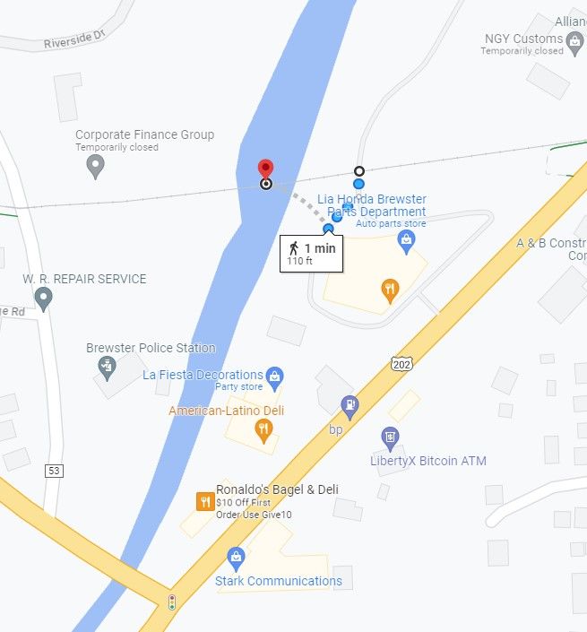
PIN 8756.84 – Maybrook Bikeway II A, Bridge #5
This project will rehabilitate the Metro-North Railroad bridge – Bridge #5 – over the East Branch of Croton River in the Town of Southeast, Putnam County, NY, and build a multi-use pedestrian and bikeway at the former railroad trackway on the southerly spans of the bridge.
The bridge was constructed 115 years ago. It consists of four truss spans crossing 30 to 50 feet over the river in pairs. The bridge abutments and central pier are ashlar masonry construction. In depth inspection of the structure revealed several deficiencies which would need to be corrected before a prefabricated timber deck bikeway could be placed across the bridge. The bridge bearings are frozen with rust and the bridge seat at the southwest corner has failed, so that the bearing is not in contact with the seat. A significant diagonal crack crosses the west abutment and several of the large ashlar masonry units have become misaligned over time.
Railroad maintenance of the bridge’s steel components was inconsistent with the northerly spans, carrying track which was seldom used but none-the-less considered active until recently, receiving most of the repair, replacement, or reinforcement as required to maintain an active track. In depth inspection identified components of the southerly spans which will be rehabilitated as part of this project. The most significant amount of work will be replacing the bridge bearings, reconstructing the bridge seats, and removing and reconstructing (with concrete) a portion of the west abutment. Remaining ashlar masonry on the west abutment, east abutment and the pier will be repointed.
A prefabricated timber deck and steel railings will be constructed on the rehabilitated bridge. A 10-foot wide asphalt paved bikeway, total 700-feet in length, will be constructed on the approaches connecting to the similarly constructed bikeway in place.
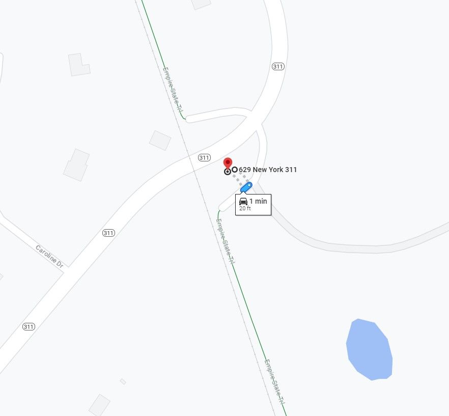
PIN 8762.43- Empire State Access Trail @ NYS RT 311
The purpose of the Project is to construct a trailhead that provides parking spaces and a connection to the adjacent Maybrook Trail which is part of the New York Empire State Trail. The trailheads will be accessible for persons with disabilities and provide features such as signage and pedestrian amenities. The trailheads will be a combination of pavement and gravel. The trail connection at NY 311 in the Town of Patterson will be concrete. Fencing, erosion control, and general grading will be performed based on site conditions.
Website Disclaimer:
Department of Public Works (DPW) makes information available on its website to enhance public knowledge and promote a better understanding of ongoing projects. The material and information appearing on this website are provided for informational use only. This website may contain and/or reference links to third-party websites. These links are provided for general information purposes only. Such third-party websites are not under DPW’s control and DPW will not be responsible for the accuracy of information contained on said sites.
